Monday, January 30, 2012

Burning Longleaf Pine Stands

Although weather conditions most of last week prevented the burning of some larger grassland tracts, the staff at the Audubon Center at Francis Beidler Forest was able to burn a small Longleaf Pine (Pinus palustris) stand when conditions improved on Thursday.  There are numerous reasons for denying a burning permit, but last week it was cool air aloft that would prevent the smoke from rising thereby causing a low-visibility driving hazard to nearby motorists.

Starting prescribed burn - Image by Mark Musselman
Longleaf Pine evolved with periodic fires that burned low to the ground, eliminated competing tree species, and exposed the soil to receive Longleaf Pine seeds. Longleaf Pine has thick bark to protect the trees from low-intensity fires that readily kill or burn other tree species.  The stand we burned on Thursday is the same stand where we planted wiregrass (Aristida stricta) and burned in November 2008 (blog entry).

Today, longleaf pine is an ecosystem in trouble everywhere in the South. Of the estimated 90 million acres in the pre-settlement forests, only about 2 million acres of mostly second-growth longleaf pine remain in scattered patches. Less than half of that is found on public lands. Those stands of longleaf in private ownership continue to decline, as landowners replace the longleaf with faster growing species such as loblolly pine. And, despite our increasing knowledge about the beneficial role of fire, especially fire during the growing season, many landowners still do not burn their longleaf pine forests, or do not burn them often enough. -- U. S. Fish & Wildlife

The key to keeping the fires low in intensity is to ensure that the excess fuel (leaves, needles, dead branches) does not accumulate on the forest floor. Note the difference in the before and after sections of the images taken during the burn.

Longleaf Pine pre-burn - Image by Mark Musselman
Longleaf Pine during burn - Image by Mark Musselman
Drip torches containing a 4:1 mixture of diesel to gasoline were used to set the fire on the downwind side of the stand, which allowed the fire to burn into the wind at a slower, steadier pace than if the fire were started on the upwind side of the stand. 

Drip torch - Image by Mark Musselman
Prescribed burn - Image by Mark Musselman
A fire break was plowed around the entire stand to ensure the fire did not migrate beyond the stand's boundaries.

Fire break - Image by Mark Musselman
Once the fire began in earnest, the smoke rising into the clear blue sky was undoubtedly visible from a great distance, especially if one had a seat high in that sky.  At one point, the roar of engines could be heard approaching at jet-like speed.  As the planes neared our burn site, the engines slowed and two pairs of F-16s circled leisurely around the pine stand.  After apparently sating their curiosity, the jets accelerated and made a thunderous exit to the west.

Pilot's log: Investigated fire...everything normal.  That's how we like it!

Sunday, January 29, 2012

Beidler Forest Summer Camp!


Get Swamped!

The Audubon Center at Francis Beidler Forest offers a choice of week-long summer day camps during June and one week-long advanced camp in July.  Francis Beidler Forest contains the largest remaining stand of old-growth, cypress-tupelo swamp in the world. This is the perfect setting for stimulating a child’s love for nature!

Dragonfly inspection - Image by Mark Musselman

With insects as the theme for the June sessions, campers will become amateur naturalists themselves by engaging in science, hands-on activities and crafts. Although insects will be the theme, campers will certainly encounter and experience the other animals in the swamp. See the tentative schedule at http://sc.audubon.org/PDFs/schedule_2012.pdf

Fawn at 2011 camp - Image by Mark Musselman

The programs for the regular summer camps are geared for grades 1 through 6. The camp day will last from 9:00 am until 2:00 pm. Please call Beidler Forest at 843-462-2150 to secure a place for your child in the week of your choice or send an e-mail to Mark Musselman at mmusselman@audubon.org.  Session III will be opened in July should the other two sessions fill.  An enrollment form can be downloaded at http://sc.audubon.org/docs/Enrollment_2012.pdf.  The cost is $85 per camper.
 
The dates for the 2012 summer camp will be:
Session I: June 11-15
Session II: June 18-22
Session III: July 23-27 
(only if above sessions fill)


Advanced Swamp Camp
For the second year, we are offering a day camp for teenagers (ages 13-16) from 9:00 am until 2:00 pm from July 16th through July 20th. The cost is $100 per camper.

Advanced camp 2011 - Image by Mark Musselman

Campers will spend the days outside exploring the various habitats throughout the sanctuary. Those unwilling to stomp in the swamp while getting wet and dirty should not apply. Activities will include GPS navigation, canoeing, fishing, wildlife identification, and whatever else we encounter!

Limit: 15 campers.
Call Beidler Forest at 843-462-2150 or
send an e-mail to mmusselman@audubon.org.

Aquatic insect collecting - Image by Mark Musselman


Friday, January 27, 2012

GIS at Ft. Dorchester High School

In 2011, Mark Musselman, education director at the Audubon Center at Francis Beidler Forest was awarded a $1000 grant by the South Carolina Geographic Alliance (SCGA).  The grant went toward the purchase of Global Positioning System (GPS) units that could be used to collect data for use in Geographic Information Systems (GIS).  Not only is that a mouthful of acronyms, it is incredibly powerful technology!

Just about everyone is familiar with GPS technology, but GPS latitude/longitude coordinates for where you are and where you wish to go have little meaning without all the GIS layers that get lumped under “GPS technology.”  The road map the shows on the navigator screen is a GIS data layer.  All the buildings shown on the map, including the critical brand name coffee shops along the way, are part of GIS data layers.  Picking a hotel that is within walking distance of your favorite coffee shop as well as a movie theater and a pizza parlor, is possible using data layers overlapping in a GIS database…and you thought you would never again use a Venn diagram.

On Tuesday, Mark Musselman took GIS data files for species and trails in the swamp and traveled to Dr. Michael Becwar’s environmentalstudies classes at Fort Dorchester High School.  In the computer lab, students began creating their own maps using the www.arcgis.com/home/ site.  With a satellite image as a base map, students could differentiate between the wetter and drier areas in the swamp based on the color of vegetative green.  The wetter areas are dominated by bald cypress and tupelo gum trees, which show as a lighter green in the image, while the slightly higher, drier areas support oaks and other trees showing as darker green on the image.  After loading the alligator sightings data layer, students discovered that alligators are not seen throughout the swamp, but found only in deep water areas where trees are not growing and sunlight can reach the Earth’s surface.  Based on that knowledge and without ever traveling to the Congaree National Park, students were able to predict where in the park’s boundaries alligators would likely be found.

Image by Mark Musselman
Later, students loaded snake data layers and discovered that brown water snakes remain toward the middle of the swamp while cottonmouths tend to be found closer to the edges of the swamp.  Referring to the free Beidler Forest app on an iPod Touch (initial units purchased with a previous SCGA grant), students learned that brown water snakes only eat fish, so they stay close to their prey in areas of deeper water.  Meanwhile, cottonmouths eat fish, frogs, snakes, birds, and rodents, so they exploit larger areas of the swamp even when those areas become dry.

Image by Mark Musselman
Finally, a quick glance at a map showing a variety of Prothonotary Warbler breeding territories was all that was necessary for students to see that all territories, and therefore all areas of the swamp, are not equal.  Territories around the nature center were shown to be exceeding large and isolated, while territories deep within the swamp at the eastern end of the boardwalk were small and densely packed.  Why?  A check of the iPod app showed that Prothonotary Warblers prefer to nest in cavities over or near water.  The western territories around the nature center consisted of dry, upland areas and therefore elicited little competition allowing for preposterous land claims.  On the other hand, territories at the eastern end of the boardwalk consisted of prime wetland habitat forcing males to settle for smaller (and quite sufficient) territories lest they exhaust themselves fruitlessly attempting to defend larger claims.


Students were able to make all of the swampy deductions noted above without leaving their school.  According to Dr. Joseph Kerski, Curriculum Development Manager for ESRI and recent president of the National Council forGeographic Education, “Accelerating globalization means that we can no longer be complacent about increasing the amount of spatial thinking in the educational curriculum at all levels.  We're also starting to realize that global issues, such as biodiversity loss, urban sprawl, energy needs, water quality and availability, natural hazards, and human health, are becoming increasingly complex and beginning to affect our everyday lives.  Moreover, they all have a spatial component.  To grapple with these issues for the 21st century requires a populace that's adept at using GIS and other geotechnologies.”  Students at Fort Dorchester High School have begun moving in that direction!

You can interact with the map and all the data layers at http://bit.ly/ycL36U.

Wednesday, January 25, 2012

Nightmare on I-95

What goes bump in the night and could not give a hoot in the morning?  A Barred Owl (Strix varia) wedged between sailboards and a truck's roof traveling at highway speeds from Jacksonville, FL to Summerville, SC!  Talk about wind chill!

Last Thursday, Mike Dawson, director of the Audubon Center at Francis Beidler Forest, got the call when crows were observed attacking the weakened owl.  Here is his account of the experience:  Got to rescue an injured Barred Owl today. Apparently last night he was hit by an SUV carrying surfboards attached to the luggage rack. Unbeknownst to the driver, the “thump” he heard was a Barred Owl being jammed up between the roof and the boards. This happened around Jacksonville, FL last night. The owl rode there for 250 miles in the wind and cold to the Hampton Inn in Summerville. This morning, the owner found the owl perched and understandably dazed on the roof of his Suburban. I bought a fishing dip net at Wal-Mart and scrounged a cardboard box and was able to easily transfer him to the box, as he was pretty woozy. I called Janet Kinser with Keepers of the Wild and she picked him up to transfer to the Center For Birds of Prey. By the time she got here, he was doing much better, more open-eyed and moving more. Nothing appeared to be broken or messed up. So, odds are it will be just fine. One lucky owl... choosing an interesting way to migrate!

Image by Mark Musselman
Image by Barbara Thomas

Image by Barbara Thomas
Image by Mike Dawson


Friday, January 20, 2012

In the News

The winter season is the slowest of seasons in the swamp and at the Audubon Center at Francis Beidler Forest.  Some birds have migrated away, reptiles become inactive, and school groups are not interested in being out in the colder weather.  However, just because thinks have slowed down one should not get the idea that news is not happening.

The Post and Courier newspaper reported that Diamondback Rattlesnakes are being relocated instead of killed to preserve the species.  "The diamondback is a keystone species in the health of the longleaf savannah ecosystem, the pines that are the heart of the Lowcountry...and moving them to larger tracts of pinelands might be the best bet for conserving what is maybe the most hated native Lowcountry species -- a 6-foot-long, muscled arm-thick, venomous viper that people have stomped, chopped, shot and even dynamited for generations when they crossed paths."

We have several tracts of Longleaf Pine and plan to restore additional tracts as the land becomes available. We have made some cursory searches for Diamondback Rattlesnakes, but we have yet to detect any on Beidler Forest property.


The South Carolina Department of Natural Resources conducts a wading bird programFrom their site:  Researchers have placed metal bands, colored bands with engraved numbers and/or letters, wing tags, radio transmitters, and satellite transmitters on a small number of wading birds. We are interested in any sightings of marked birds. This information helps us to learn about the movement patterns and life spans of wading birds. More information about the purpose of banding birds can be found at the Bird Banding Lab website.

If you see a live bird with an engraved color band, we would appreciate it if you could attempt to read the numbers/letters on the band. Please also record the species of the bird, the color of the band, the color of the letters, which leg that band was attached to, and the location of the bird and send the information to wadingbirds@dnr.sc.gov. Photographs of the bird and the band are also very helpful.

If you find a dead bird of any species wearing a metal band, please report the band number to the Bird Banding Lab through their website or by calling 1-800-327-BAND (2263).


The South Carolina Department of Natural Resources also issued a news release regarding the value of snags.  The Post and Courier newspaper ran a brief article on the subject and used one of our images.


Using our image was appropriate as we have an ample of supply of snag in the old-growth swamp...


and as this Pileated Woodpecker shows, there is a bounty of food in the dead wood!


Using a Wasp to Catch a Beetle: The Quest to Save Ash Trees - The non-native Emerald Ash Borer arrived on a boat from Asia and is eating its way through millions of ash trees.  We have plenty of ash trees at Beidler Forest, so we don't relish the thought of these beetles making their way here.  The wasp technique described in the article was not used here when researchers checked for the Emerald Ash Borer two years ago.  Instead, traps with the attracting scent of a female were hung from trees.  Note: moving firewood to other areas is one way for these and other insects can reach and infest areas faster than they could naturally expand their range.


Images by Mark Musselman

Thursday, January 19, 2012

Great Backyard Bird Count 2012


The 2012 Great Backyard Bird Count will be held during February 17-20.
 

From the National Audubon Society GBBC webpage:

Bird enthusiasts across the U.S. and Canada are gearing up for the Great Backyard Bird Count. It’s not too late to participate in the February 17-20 event. It’s free to participate, and everything is available online. The GBBC is open to anyone, including novice bird-watchers and students. Participants don’t need to be able to identify every bird, and the online submission process helps check their accuracy and prevent errors. Out of excuses yet?

Here’s a quick guide to what’s involved:
1. Make a plan: You’ll need to count birds for a minimum of 15 minutes on one of the count days, but you can count all four days, and you can count for as long as you want. More counting = more data to show us where the birds are.

2. Know your place: Decide whether your count is a STATIONARY COUNT, like watching a feeder out the window, or a TRAVELING COUNT, such as birding during a hike. Print out a data form so that you’ll know what information to record, and a regional bird checklist to help with identification.

3. Count: Record the highest number of each species seen together at one time in stationary counts. For traveling counts, record the total number of individual birds of each species you see during the walk. For more info, visit http://www.birdsource.org/gbbc/howto.html.

4. Report: Enter your findings through the website by clicking on “Enter Your Checklists!” and following instructions.

5. Spread the word: Tell others about your experience. Find out how to be a GBBC ambassador by clicking “Get Involved” on the website. Also, join the GBBC Facebook group, and tweet about the count (use #GBBC when tweeting).

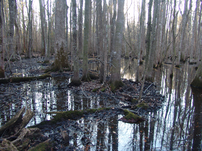
Today, we received a report of Sandhill Cranes in a field between Beidler Forest and Harleyville.  Even though it is not time for the Great Backyard Bird Count, Sandhill Cranes are only in the area during winter and always worth a short drive to see.  When we arrived at the field, the cranes had moved on for the day.  We'll stop by in the morning and try to get some images.


Although the Sandhill Cranes were absent, we saw plenty of Eastern Meadowlarks, Red-winged Blackbirds, and Common Grackles along with several Red-tailed Hawks, American Kestrels, Northern Flickers, Eastern Bluebirds, European Starlings and the Loggerhead Shrike shown below.


Loggerhead Shrikes use the hook at the end of their bill to kill a variety of prey from large insects to mice, lizards, and even birds!  Shrikes also impale their prey on thorns or barbed wire to impress a potential mate or to hold the prey in place while it is torn apart and consumed.

Attack dive

You do not need to know any such delicious avian facts to participate in the GBBC nor do you need to drive out to the country.  Stay in your backyard, visit someplace new, or join a group like the following:

Mark Musselman, education director at the Francis Beidler Forest, will be birding at various sites around Summerville on Day 1 (Friday, February 17th).  The count will begin at the parking area near the tennis courts in Azalea Park at 8:30 a.m.  Other stops may include the nature trail at Ashley Ridge High School, The Ponds community, and Middleton Place.  Anyone can join him for all or part of the day, especially those looking to learn about birding or improve their bird identification skills.  Anyone wishing to join this group or simply to follow the progress can check @TheSwampThing (http://twitter.com/#!/TheSwampThing) on Twitter.

Though a pair of binoculars will be useful to help with the GBBC, only a healthy curiosity is required!

Images by Mark Musselman

Wednesday, January 18, 2012

Gone Hog Wild!

Actually, they are Wild Pigs (Sus scrofa), but either label congers images of a mess.  Wild pigs are in Four Holes Swamp and have begun to frequent the area around of the boardwalk.  We have noted the negative effects of this issue before in this blog and the South Carolina Department of Natural Resources and the Clemson Extension have dedicated substantial resources toward the increasing problem...and it's not just a problem in South Carolina as a quick Google search reveals.

Signs of pig activity can be seen around the southern leg of the boardwalk, which traces a path along the edge of the swamp.  Pigs root through the soil in search of food, which can turn the soil up to three feet deep, disturbing the habitat sufficiently as to make it unsuitable for native plant and animal species.


Pigs also create extensive wallow areas, think large mud puddles, to help cool their bodies and rid themselves of parasites.  This makes the swamp quite attractive to the pigs.


A major obstacle to the removal of invasive pigs is the inability to be at the same place at the same time as the pigs.  We have set up cameras to see if there is a pattern to the pigs' mainly nocturnal movement, but have yet to capture images showing that species of mammal.  However, we have plenty of images for the ubiquitous Eastern Gray Squirrel (Sciurus carolinensis).


We have also set a trap in the upland area beyond sight of the boardwalk.  Significant damage has been done to that habitat as pigs have rooted around in search of plant and animal meals.


The gates at the front of the trap swing to allow access into the trap, but cannot be pushed in the opposite direction to allow pigs to exit the trap.  So far, the corn bait has only attracted hungry raccoons (Procyon lotor) and passing interest from a wary pig or two.


Finally, even the beavers (Castor canadensis) are likely tired of their invasive mammalian kin.  During a recent swamp stomp, we noticed that pigs had been rooting within the beavers' dam and had created numerous breaches along the structure.


Images by Mark Musselman

Wednesday, January 11, 2012

Other Wildlife at Ashley Ridge

Last week, we reported on the Rusty Blackbirds (Euphagus carolinus) foraging in the flooded forest along the nature trail at Ashley Ridge High School.  Rusty Blackbirds filled that blog, so now it is time to report on the other things we saw during our walk.

The first thing we noticed once we hit the trail that runs parallel to the water-filled drainage ditch was the abundance of otter scat marking their territory!  There appears to be copious amounts of crayfish, frogs, and fish in the water.


Upon inspection of the scat, both old and recently-deposited, it appears that the otters have an easy time finding crayfish.


While watching our step to avoid slipping in a pile of odoriferous otter scat, we found a portion of shed snake skin.  We did not attempt to positively identify the species of snake, but based on the abundance of aquatic and semi-aquatic prey, we bet the skin belonged to one of the water snakes.


Approximately halfway along the trail, we came upon a fallen tree that showed signs of excavation at the root end.  A variety of animals might excavate the soft interior of a fallen tree in order to find shelter, but that was not the purpose if this excavation.  Food had been deposited within the fallen log.  The turtle that laid the eggs had not meant for them to become food, but a raccoon's sensitive nose likely alerted the mammal to their presence during its nocturnal stroll along the trail.


Turning from the pilfered nest, we spied a praying mantis moving along a stake standing in the middle of the ditch.  The mantis has wings, but it made no attempt to fly from the stake to dry land.  By inspecting the mantis through our binoculars, we noted that one wing appears damaged and protruded from its body at an odd angle.


The praying mantis may be looking at its own reflection and contemplating its predicament or it may be assessing risk of fish predators might pose during a short swim to the ditch's edge.


Meanwhile, a Black Vulture (Coragyps atratus) flew high patrol waiting for death to take its next victim and call the bird to dinner.


Images by Mark Musselman

Tuesday, January 03, 2012

Rusty Blackbirds at ARHS

We have previously highlighted the Rusty Blackbird  (Euphagus carolinus) in this blog, buy on December 14, 2011, we caught a quick glimpse of eight Rusty Blackbirds by #6 along the boardwalk at the Audubon Center at Francis Beidler Forest!  Last week, we had lengthier observations along the nature trail at Ashley Ridge High School.  Although the nature trail is but a quarter mile long through a small wooded wetland, the habitat continues to offer excellent wildlife observation opportunities! More on that tomorrow, but today's focus is on the Rusty Blackbird.


From eBird:
 A century ago, the Rusty Blackbird was an incredibly abundant bird. Accounts from the period detail spectacular spring migrations between the species' wintering grounds in the bottomland forests of the southeastern United States and its breeding grounds in the forested wetlands of North America's vast boreal forest. Ornithological reports from New England and southern Canada describe waves of tens to hundreds of thousands of Rusty Blackbirds blackening the earth and clouding the sky in the spring. In many communities, the migration of Rusty Blackbirds was likened to the year's first chorus of tree frog--a sign that spring had finally arrived in the thawing countryside.

Today these reports seem unbelievable since Rusty Blackbirds populations have suffered one of most staggering population declines of any bird in North America. An understanding of the Rusty Blackbird's habitat requirements is urgently needed to conserve its remaining populations. This is especially true during spring migration when Rusty Blackbirds congregate in large flocks which may be particularly vulnerable to habitat losses, blackbird control programs, or other disturbances.


Russell Greenberg, director, Migratory Bird Center on the Great Backyard Bird Count (coming Feb. 17-20, 2010!) webpage:
It is particularly disturbing to monitor a decline and not have a specific, definitive underlying cause. But considering the distribution and ecology of this elusive species, the search for the culprit becomes almost like the Agatha Christie novel where all the suspects were guilty.

So this is what we know. The Rusty Blackbird has a geographically extensive breeding range from New England to Alaska throughout the boreal zone in forested wetlands. The species is strongly associated with wooded wetlands in the winter as well, although foraging birds can be found in agricultural settings, particularly in association with livestock. The species is more insectivorous than other blackbirds, often foraging in single species flocks, not associated with blackbirds, and (based on experiments by Claudia Mettke-Hofmann) is more averse to novelty when feeding than other blackbirds. The last observation suggests the bird may be less adaptable in the face of rapid environmental changes.

From this we can suggest a number of factors leading to the decline: Winter habitat loss due to conversion of wooded wetlands to agriculture. At least 80 percent of the bottomland hardwood habitat has been converted since European colonization. Habitat loss may have caused the Rusty Blackbird to feed in more open habitats where it is more exposed to competition with birds such as Common Grackles and Red-winged Blackbirds. Wintering ground problems could have been exacerbated by large losses during blackbird control programs in the 1960s and 1970s. It should be noted that the species is still listed as a pest species in a number of states and thus still subject to more modest control programs aimed at blackbirds.

Breeding habitat loss and degradation, including boreal wetland drying and changes in water chemistry due, directly or indirectly, to global warming. Birds associated with boreal wetlands have shown consistent cross-species declines. Global warming is suspected in causing major changes in the extent of boreal wetlands, the chemistry of the waters, and the structure of invertebrate communities. Peat production, logging and reservoir formation have contributed both to direct loss of boreal wetland and profound changes in hydrology, particularly in the eastern portion of the species range.

The eastern portion of the range is where, historically, the species may have achieved the highest breeding densities and is also the region where it has shown the greatest decline. Acid rain and mercury accumulation (an only recently detected problem in songbirds) may be differentially affecting boreal wetlands in the East. The Rusty Blackbird may be at higher risk for accumulated mercury than other blackbird species because of its preference for feeding on aquatic invertebrates and small fish. Its preference for wetlands with acidic soils may also make the effect of acid rain on calcium loss particularly great in this species.
(see our blog for mercury-related entries)


Once again, conservation of habitat is critical to the survival of a species.  We too have habitat requirements.  By protecting critical habitat for other species, we benefit ourselves.

Images by Mark Musselman