Saturday, December 30, 2006

Otters


Winter is the time of year when River Otters (Lutra canadensis) are spotted along the boardwalk and canoe trail. We don't know where the Four Holes Swamp otters spend the remainder of the year, but when the weather and water turn cool, otter sightings increase. Maybe it is the generally higher water levels or the absence or inactivity in the reptile population, especially alligators.

Otters spend the majority of their time in the water and much of that time under it. They can spend up to four minutes below the water's surface with their ears and nostrils sealed as they hunt for crayfish, fish, frogs, mollusks, and snails. Although the majority of their dives do not result in captured prey, otters are well-designed for high-speed maneuverability underwater.

Otters can also be playful during their hunting forays. Today on the canoe trail, an otter was observed chasing a Yellow-bellied Slider (Trachemys scripta scripta) into the water from of its sunning perch on a log. The pleasure derived from popping up next to the turtle and surprising it appeared to be the only motivation the otter needed. This is not the first time this behavior has been observed here in the swamp.

Otters give birth to 2-4 pups between late winter and early spring. The young can fend for themselves around six months, but generally stay with their mom for a year. Although mom will keep her newborn pups out of view, the spring is a wonderful time to visit the Francis Beidler Forest.

Wednesday, December 27, 2006

Quiet Time


FBF was closed on Christmas Eve and Christmas and will close again for New Year's Eve and New Year's Day. In between, the center is being operated with a minimum staff. We hope you too have taken the opportunity, like the White-tailed Deer (Odocoileus virginianus) in the image, to relax and enjoy the wonderful opportunities life has to offer!

Friday, December 22, 2006

National Recreation Trails


The boardwalk trail at the Audubon Center at the Francis Beidler Forest is now recognized with its own page on the National Recreation Trails site. Take a look and help spread the word about this special place in the swamp. Conservation, especially of a unique habitat, is nothing to keep secret!

Thursday, December 21, 2006

Longleaf Pine (Pinus palustris)


The longleaf pine/wiregrass ecosystem is unique. The longleaf pine is a hardy species resistant to wind, insects, disease and fire, which can subdue its frequently-seen cousins the Loblolly and Slash Pines. The longleaf pine/wiregrass ecosystem developed with fire and it remains healthy as long as it periodically burns. Historically, these fires would have been caused naturally by lightning and allowed to burn slowly through the forest. The result would have been the near elimination of leaf litter and debris and the competition from hardwood tree species. Additionally, longleaf pine seeds fare better on exposed mineral soil, so the next generation of longleaf pines gets its start after a fire clears the forest floor.

The longleaf pine/wiregrass ecosystem is greatly diminished throughout the Southeast and the total acreage continues to decline. Previously, over 90 million acres supported the unique longleaf pine/wiregrass ecosystem, while only two million acres remain today. Some reasons for this decline include the suppression of fires, intense logging, a switch to faster growing pines, and the clearing of land for agriculture and development. Not only is the total longleaf pine/wiregrass acreage declining, over 30 species of plant and animals that are associated with that ecosystem are currently listed as threatened or endangered, including the Red-cockaded Woodpecker!

FBF has planted several stands of longleaf pine and wiregrass within the sanctuary in an effort to restore this native ecosystem. Today, a recently acquired piece of property was burned in preparation of longleaf pine planting next month. Prior to the purchase, the land had been logged, so the burning removed debris, exposed the mineral soil, and eliminated any hardwoods left after the logging. Using drip torches, six staff members from FBF and Silver Bluff plus two neighbors took less than three hours to burn the forty acres.

Wednesday, December 20, 2006

ATVs


On Saturday, riders on four ATVs followed the Santee Cooper power lines and crossed neighboring property to get bogged down in the sanctuary at FBF. The sound of engines roaring brought the staff out of the building to investigate. Although the group departed after being notified that they were trespassing, the damage had already been done.

Although Santee Cooper has a right-of-way for their power lines as they cross the sanctuary, they do not own the land beneath the lines. It may appear to the casual observer that the land below the power lines is unproductive and therefore an intrusion would go unchallenged. No harm, no foul. Unfortunately, the situation is not as simple as it may appear.

During her three years of studying Spotted Turtles (Clemmys guttata), Dr. Jacqueline Litzgus discovered that the power line right-of-way was crucial to the community of FBF turtles. Not only did all turtles use the open area to bask, but gravid females spent additional time in the plentiful sun. Something that is a premium beneath the dense canopy of the old-growth forest.

Gravid female Spotted Turtles
spent a considerable amount of time on or at
the edge of a powerline right-of-way during
April, May, and June (Spring and Nesting subseasons;
Tables 3, 4). In addition, females nested
on the edge of the powerline and in relatively
recent clearcuts (~5 years old) peripheral
to the Beidler Forest boundaries.
(from Copeia, 2004)

Spotted Turtle populations are diminishing throughout their range, mainly due to habitat loss. In fact, Dr. Litzgus chose the Francis Beidler Forest as her southern study site because populations farther south in Georgia and Florida were no longer viable. The Francis Beidler Forest has a healthy Spotted Turtle population. Unfortunately, the ATV riders chose the exact area under the power lines where Dr. Litzgus noted the frequent basking of the Spotted Turtles. Although the turtles are not in the area at this time of year, the sediment churned into the water certainly affected the organisms that were present. Additionally, the habitat to which the turtles will return in the spring has been negatively altered by the tracks of the ATVs and the soil-slinging manner in which those vehicles were driven.

Someone owns the land. If it is not you, you need to ask permission before entering because the situation is not always as simple as it may appear.

Tuesday, December 19, 2006

Mystery Solved


Earlier this month, we found a group of black insects eating the remaining flesh off of a dead fawn's lower jaw. The creatures consisted of black plates that widened from the head to the thorax and then tapered rapidly to the end of the body. Six legs were located under the widest portion of the body. They moved away rapidly when disturbed. The image shows one that was captured for identification and stored in alcohol. The legs are curled underneath the body.

There are a multitude of insects that arrive at a dead body and aid in the recycling of the soft tissues. We search but could find nothing that resembled our specimen. Finally, a search of images on the web revealed that our specimen was not an adult, but the larva of a carrion beetle, which are difficult to identify if they are not allowed to mature to an adult.

The second image shows one possibility. Adult American Carrion Beetles (Necrophila americana) are shown last summer eating and mating on the carcass of a raccoon near #9 on the boardwalk. The adults will lay eggs on or near the carcass and dine on fly larvae to reduce the competition for their own larvae. The beetle larvae will feed in or under the carcass and on fly larvae. The beetle larvae will pupate in a soil cell nearby.

Although this topic is not appetizing for humans, the variety of carrion insects help keep the environment from becoming knee-deep in smelly carcasses.

Monday, December 18, 2006

Gator Summer

Today was even warmer (close to 80F) than this weekend making it feel more like summer than Christmas in the swamp! Visitors reported seeing the alligator (Alligator mississippiensis) in Goodsen Lake at the end of the boardwalk. The image shows a similar alligator downstream in Mallard Lake.

In this area, the alligators are generally inactive between October and March. Alligators spend the winter in burrows or "dens" that they dig, but will venture out on a warm day. Studies of captive individuals have shown that alligators eat less when the temperature drops below 80F and stop eating all together once the temperature drops below 73F. Alligators can even survive the occasional freeze by keeping their nostrils above the water, even if their bodies are trapped in the ice! They can easily survive on their energy reserves, since their medabolic rate is slowed dramatically.

Winter may only be four days away, but it sure feels like Gator Summer!

Saturday, December 16, 2006

Still


For some reason, this image of the long-lost still will not post to yesterday's entry. Note the patina on the copper piece against the tree.

Friday, December 15, 2006

Lost In The Woods

There are plans to build a 20-foot observation tower at the boardwalk platform at Goodson Lake. There are many administrative and engineering hurdles to clear before that becomes a reality. One proposal requires special equipment to place into the swamp bottom the four poles that will support the structure. That equipment is too large to travel to Goodson Lake via the boardwalk. However, 30 years ago there was an old road that approached Goodson Lake from the south (opposite of the boardwalk).

Today, we set out to locate the lost road and determine if it would be feasible to move the equipment to Goodson Lake along that path. We were successful in locating the majority of the road. Some trees have grown up between the tire ruts, but the forest is sufficiently open to allow the equipment to navigate around those obstacles. Therefore, an approach from the south is feasible. However, it is the other items that we found lost in the woods that captivated our attention.

First, we found a long-lost radiosonde that was likely launched by a weather service office to collect data in the upper atmosphere. Below is an excerpt from the National Weather Service office in Charleston, SC:

Upper-air
We release a helium-filled weather balloon at 6 AM and 6 PM LST (Local Standard Time) each day. The balloon carries a small battery powered radiosonde which collects weather data as it rises to around 10 miles above the Earth's surface. When the balloon bursts it has expanded to the size of a room in a house; a parachute then carries the re-usable instrument back to the surface. Ground equipment at our office tracks a radio frequency sent by the radiosonde so that we may get a vertical cross section of pressure, humidity, and temperature measurements. The ground equipment also computes wind speed and direction at various heights above the surface. This is done by calculating the radiosonde's change in position with time relative to the ground station. A computer codes the upper air data, and it is sent to a national supercomputer in Washington, D.C. for input to the forecast models. With a worldwide network of three dimensional upper air observations, weather forecasts of temperature, clouds, and precipitation can be produced for periods up to 7 days into the future.

Of greater interest was the remnants of a whiskey still and a gallon jug holding a small amount of clear liquid. Besides hunting, fishing and hiding from the British, the swamp was perfect for hiding illegal stills. The rusted 55-gallon drums and copper pieces were located within 150 feet of the boardwalk near #12. The pieces of the still have been there for over 35 years only now to be discovered. The swamp really is a great place to hide or get lost!

Thursday, December 14, 2006

Web Page Changes


Keep your eye on the web pages for Audubon South Carolina and for the Audubon Center at Francis Beidler Forest. We plan to redesign the site for easier navigation. In the meantime, subtle changes will be added for those planning a trip to the swamp. For example, you can now check the weather and the forecast for the area around Four Holes Swamp by visiting the Francis Beidler Forest homepage.

Wednesday, December 13, 2006

GPS at Clay Hill Middle


The teachers and students at Clay Hill Middle School are participating in the "Using the Environment as an Integrating Context for Learning (EIC)" School Network and Mark Musselman, Education Director, is a mentor.

The South Carolina Geographic Alliance (SCGA), in conjunction with the education department at the Francis Beidler Forest, is developing a program to incorporate Global Positioning System (GPS) technology into South Carolina classrooms. Clay Hill Middle School is the model for the campus application. Today, the teachers used GPS receivers, provided by the SCGA, for the first time. Today's teacher orientation will be followed by the development of a practice GPS course on campus for students to hone their navigation skills. Next, students will move away from school and explore their community using lessons developed for GPS technology. Finally, students will visit and explore the Francis Beidler Forest with the GPS receiver as their guide.

For those with a GPS receiver, the coordinates for Clay Hill Middle School in Ridgeville, SC are: N33 05.571, W080 18.737

Monday, December 11, 2006

Photo Contest Winners


The Audubon Center at Francis Beidler Forest won 2 of the 18 categories in the National Recreational Trails 2006 photo contest! All of the winning photos can be seen here.

FBF won in the trail Accessibility category with an image showing the boardwalk along the edge of the swamp between #13 and #14. FBF also won in the Wildlife and Habitat category with an image (shown in this blog entry) of a Barred Owl (Strix varia).

The remaining entries for FBF can be viewed here.

Saturday, December 09, 2006

Ruby-crowned Kinglet


Many of the birds that nest in the swamp at the Francis Beidler Forest are spending our winter in the warmer climates of Central and South America. However, there are still birds to be seen from the boardwalk, including the season-appropriate colors of the Ruby-crowned Kinglet (Regulus calendula). For more than 10 minutes, the bird in the image was observed searching under and between the fronds of the Dwarf Palmetto (Sabal minor). Several other images show the bird with what appears to be a large spider in its bill and later the larva of an insect. The bird was quite rapid in its movements and when it appeared from behind a palmetto frond it was difficult to capture in the camera frame.

The sound of the Ruby-crowned Kinglet can be heard here.

Friday, December 08, 2006

Boardwalk


The 1.75-mile long boardwalk at Francis Beidler Forest was contructed between October 1976 and July 1977. The size of the work crew varied, but after three weeks of help from the folks at the Audubon Sanctuary at Corkscrew Swamp (FL) the crew was usually four individuals. Using hammers, saws and post-hole diggers, the boardwalk snaked through the virgin, old-growth forest from the nature center to Goodsen Lake and back again. On a good day, the crew could build 180 feet of boardwalk, but days of hitting roots with the post-hole digger or deep water kept the average feet per day at 120'.

In 1989, Hurricane Hugo blew through and damaged nearly half of the boardwalk. As the years go by, trees die or are blown over by stormy weather and they may land on the boardwalk. The image shows such an event. The staff will then load the cart with lumber, nails and tools and head to the accident scene. In just over an hour, they can have fresh lumber spanning the gap caused by the downed tree or limb. However, over half of the boardwalk remains original lumber nailed down between 1976 and 1977 and is in need of replacing. Soon a new, slightly wider, ADA-compliant (Americans with Disabilities Act) boardwalk will begin snaking over the same path as the one laid down 30 years ago.

Wednesday, December 06, 2006

Gift Buying


It is the time of year when everyone on staff needs to hone their singing clock packing skills!

There are numerous items for sale in the swamp gift shop and several can be found online here in the menu on the left. By far the most popular item is the singing bird clock. Each hour provides a different songbird call. There are two sets of birds with one set shown in the image. The clock in our office has the other set of birds. Like a Pavlov experiment, the staff seems to respond most damatically to the call of the Tufted Titmouse. No surprise...that bird is perched at 5 o'clock.

Order now and help protect the birds!

Tuesday, December 05, 2006

FBF-specific Field Guide


More work was accomplished today on a Francis Beidler Forest-specific field guide. Visitors will not need to get this close to any of the animals to be able to identify what they are seeing. There is also no need to page through a collection of plants and animals that are not in the area around the boardwalk.

There are plenty of little yellow birds in the world. However, there is only one little, yellow-headed bird near the boardwalk. When the field guide is completed, it should be quite simple to identify the Prothonotary Warbler (Protonotaria citrea). The startled snake is an Eastern Cottonmouth (Agkistrodon piscivorus piscivorous).

Monday, December 04, 2006

GIS


GIS stands for Geographic Information System. This software allows one to take a mountain of data and view it graphically in any desired combination. In this way, patterns and relationships can be more easily detected.

The image shows a bird's-eye view of the boardwalk here at the Francis Beidler Forest. The nature center and the beginning of the boardwalk are at the upper left. Goodsen Lake is shown at the lower right. North is at the top of the image. The only data layers shown are the boardwalk and the species (flora and fauna) sighted over the last few years. However, there are also layers that show the buildings, the canoe trail, the low boardwalk trail, the property boundaries, access gates, etc. What makes GIS technology a powerful tool is the user's ability to view the data separately or in combination with other, sometimes seemingly unrelated, data.

The species data are shown as individual points in the image with each type (plant, mammal, bird, reptile, insect, fish, etc.) shown in a unique color. Though the separate dots are difficult to see in the image, the software allows the user to zoom in. It should be clear that the green dots are the most seen animals. Based on our organization's focus, one could guess that the green dots represent birds.

Using the data shown in the image as an example, there are over 3100 species points in the data table. In April, if a nature photographer only had an hour before she had to depart for the airport and she desperately wanted to take a picture of an Eastern Cottonmouth (Agkistrodon piscivorus piscivorus), where on the boardwalk would she likely have success? Simply looking through the table for the data to answer that question would be difficult and extremely time-consuming. However, by posing that query using the GIS software (date, cottonmouth, close to the boardwalk), only the appropriate data points would light up. In seconds, you could tell the photographer to go to #4 or the stretch between #8 and #10.

Sunday, December 03, 2006

Trees In The News


Below is an excerpt from an article appearing in the Home and Garden section of today's The Post and Courier:

SUNDAY, DECEMBER 03, 2006 8:01 AM
TERRIFIC TREES

BY DAVID QUICK
The Post and Courier

Lowcountry residents love their trees.
It's quite obvious from the response The Post and Courier received earlier this fall when we sought nominations for "terrific trees of the Lowcountry."
The outpouring was overwhelming. Dozens of letters, e-mails and pictures came in for weeks.
The notes often spoke of favorite trees as if they were family.
In many ways, they are. What would our community be like without the sprawling, moss-draped live oaks, towering bald cypresses and pines, and flowering accents of dogwoods and crape myrtles?
The South Carolina coast, despite being strafed by hurricanes and tropical storms on a regular basis, has some majestic trees.

[section omitted]

Swamp giants
While live oaks are found in many visible locations from parks and yards to roadsides and shopping centers, another of the South's great trees is more often found in less accessible swamps.
One of the best local places to see the "Angel Oaks" of the bald cypress species is Francis Beidler Forest near Harleyville.
"We have a couple of beautiful ancient bald cypress trees visible from the boardwalk at the Francis Beidler Forest," says Mike Dawson, director of the Audubon Center at Francis Beidler, which protects one of the largest tracts of virgin, old growth forests in the Southeast.
"They are not record-breakers, as our nutrient conditions in the swamp are pretty poor," he says. "They are, however, in the neighborhood of 1,000 years old and still pretty impressive."
The center's education director, Mark Musselman, cleared up one myth about bald cypress, which is a relative of the West's giant redwood trees and is considered a deciduous conifer.
"Cypress do not prefer water," says Musselman. "As one views the ancient cypress standing on their flooded trunks, that statement may seem ridiculous. But plants do not like or dislike where they are: They simply live wherever they are able to survive.
"As in most plant communities, the swamp forest is highly competitive. Such essentials as sunlight, nutrients and root space are in limited supply. Those plants best able to find and use the essentials will thrive. Others will not."
While former Lowcountry resident John Stamp didn't submit a massive cypress as one of his favorite trees, he did offer up one that is in the middle of a large pond at Audubon Swamp.

[section omitted]

This article was printed via the web on 12/3/2006 12:06:34 PM . This articleappeared in The Post and Courier and updated online at Charleston.net on Sunday, December 03, 2006.

Friday, December 01, 2006

Chiggers

After climbing off of the boardwalk the other day to show some Cub Scouts a raccoon skull, it was discovered that another creature has emerged due to the warmer weather...chiggers! Half of the Beidler Forest staff is unaffected by chiggers and did not know that they existed until the staff doubled in size. The new staff members are certified chigger magnets whenever they venture off of the boardwalk into the forest!

A detailed explanation of the chigger life cycle can be found here. Basically, the chigger is only parasitic during its larval stage. When a human or a variety of other animals enter an area with chiggers, the larval chiggers rapidly swarm onto the host and begin searching for a good feeding spot. On humans, chiggers prefer areas of thin skin (ankles, behind knees, in front of elbows, armpits, abdomen, groin) or areas where clothing is tight (socks, elastic areas of underwear, waistbands, thighs in tight jeans). The chiggers find a skin pore or a hair follicle and feed be delivering powerful digestive enzymes and then sucking up the liquefied cells. Yum! The enzymes cause the surrounding cells to harden into a straw-like feeding tube. The combination of these two actions causes the incredible itching (in many people). The chigger will drop off in one to four days, but the itching can last for over a week. Since the chiggers tend to group together in their environment, it's unlikely that a person will only have a few bites. The cumulative effect of multiple itching bites can be maddening.

There are some on staff that welcome the impending cold front and the tremendous effect it will have on reducing the active chigger population.

Thursday, November 30, 2006

Summer?


With highs again near 80 F, it was another banner day for seeing reptiles. Second graders from Fennell Elementary School in Hampton County and cadets from The Citadel saw 7 Eastern Cottonmouths (Agkistrodon piscivorus piscivorus), 5 Banded Water Snakes (Nerodia fasciata fasciata), 1 Common Snapping Turtle (Chelydra serpentina), numerous Carolina Anoles (Anolis carolinensis), and numerous Yellow-bellied Sliders (Trachemys scripta scripta). The Barred Owl (Strix varia) took time near the boardwalk to hunt the abundant prey lured out by the warm weather. The garbage cans were too smelly for the normally-nocturnal Opossum in the image to resist.

Enjoy it while it lasts, because the cold front will push through tomorrow bringing rain and at least a 20 degree drop in the high temperature!

Wednesday, November 29, 2006

Snakey


While we walked around the boardwalk and thought of species to include in a new FBF-specific field guide, plenty of snakes made appearances in the unseasonably-warm weather to ensure their entries on the pages. There was a Eastern Cottonmouth (Agkistrodon piscivorus piscivorus) sunning on the fallen cypress by #4, a young Banded Water Snake (Nerodia fasciata fasciata) sunning on a branch by #7, a hefty Eastern Cottonmouth sunning near its den at the base of a cypress along the boardwalk spur at #11, another Eastern Cottonmouth half out of its stump den just outside the nature center, and the Greenish Rat Snake (Elaphe obsoleta x quadrivittata) shown in the image that was swimming near #5. Unfortunately, a Southern Copperhead (Agkistrodon contortrix contortrix) found the driveway quite warm and a visitor's car quite heavy.

Saturday, November 25, 2006

Rivalry Football


On this day in South Carolina, nothing seems to be more important than the Carolina-Clemson football game. This year, the University of South Carolina beat Clemson University 31-28.

Friday, November 24, 2006

A Visit From Texas


Skinny from Texas appeared at FBF today. Skinny, whose homepage is here, is a travel bug for the Global Positioning System (GPS)-based geocaching. Skinny was deposited in the nearby cache For The Birds (GC4460) here .

Each of Mrs. B's 4th grade students at Kenneth Davis Elementary School received a travel bug tag and created a travel bug to explore the world outside of Texas. Unfortunately, Skinny appears to have spent most of the time since June in the bottom of some geocacher's backpack. In the image, Skinny is already reading about the Francis Beidler Forest. We'll make up for the lost time and ensure that the students in Texas become experts on the spectacular, virgin, old-growth forest!

There is one issue with Skinny. It appears to be a warthog or possibly a feral hog (Sus scrofa). Feral hogs have become a problem at FBF due to their destructive rooting behavior and their prolific reproduction. We'll assume Skinny is a tourist and will be moving on once the learning has been accomplished.

Thursday, November 23, 2006

Happy Thanksgiving!


The Audubon Center at Francis Beidler Forest is closed today to allow the staff to enjoy the day with their families. The Wild Turkey (Meleagris gallopavo) in the image was showing his best in May along the driveway into the FBF. We're betting that today he is thankful, as we are, for the sanctuary in the swamp and for all those that help preserve this and other natural areas.

Happy Thanksgiving! We'll keep the menu a secret from Tom.

Wednesday, November 22, 2006

Lowcountry Snow!


Yesterday, Charleston and Savannah reported the earliest measurable snow on record. In the image, the area just to the west of Four Holes Swamp received 1" to 2" of snow.

Another Rainy Day!

Not everyone is opposed to a couple of rainy days. Visitation on the boardwalk suffers in this weather, but those on the canoe trail waiting list don't mind. The water will be high enough for canoes to navigate the trail for many days to come.

The treefrog in the image found that the rain gauge is not only a moist spot to spend the day, but the acoustics are terrific!

Tuesday, November 21, 2006

Rainy Day

Rain, wind and
dropping temperatures caused today's Harleyville-Ridgeville school group to cancel and has kept all others away as well. This is a good day to catch up on administrative work.

Turtle Island

Turtle Island is for the birds ... officially
DAVID LAUDERDALE, Packet columnist
Published Sunday, November 19, 2006

Finally, some good news about coastal birds -- too often reported clinging to life on a wing and a prayer because bulldozers don't make good nesting sites.
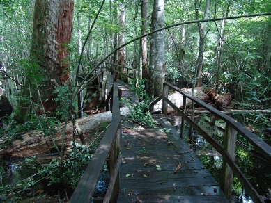
Turtle Island between Daufuskie Island and Savannah has been designated an Important Bird Area.

A flock of local and state bird enthusiasts were to cross the waters to Daufuskie Island on Saturday to toast this good news about one of the last remaining undisturbed barrier-island beaches in South Carolina.

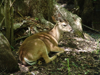
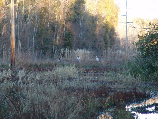
Turtle Island is uninhabited by humans, and the birds are making the most of it. That's crucial as the Lowcountry becomes urbanized at an alarming rate.

To be an Important Bird Area speaks loudly for the value of land conservation. But it doesn't carry a big stick. It's not a politically binding designation that would hold up in court.
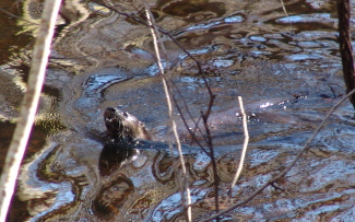
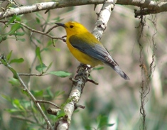
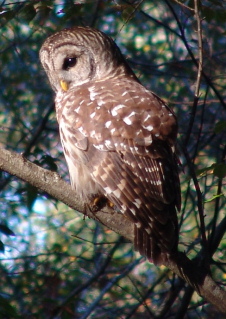
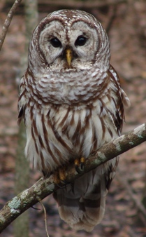
It simply recognizes the 1,720-acre island as an important nesting, resting or foraging place for shorebirds. It is a safe haven for the piping plover, which is protected under the
Endangered Species Act, and three other birds on Audubon's "watch list": the American oyster catcher, Wilson's plover and the red knot. And at least 1,000 birds from seven other species, including the black-bellied plover and the least tern, occupy the island at least part of the year.

The Turtle Island success story really started on Dec. 1, 1975. That's when the old Union Camp, now part of International Paper, donated it to The Nature Conservancy. It quickly was transferred to the S.C. Department of Natural Resources and is now the Turtle Island Wildlife Management Area.

Tom Murphy, a DNR biologist, sees the new designation as proof of his agency's good stewardship and careful monitoring of birds. Audubon South Carolina has been working for years to identify Important Bird Areas. Turtle Island is the 41st site in the state, covering a total of 1 million acres. Others nearby are the Sea Pines Forest Preserve, the Pinckney Island and Savannah National Wildlife refuges, Bay Point Island on Port Royal Sound, and the Webb Wildlife Management Area near Ridgeland.

And when we talked Friday, Murphy shared more good news about birds in our neck of the Lowcountry: The population of sea birds -- gulls, pelicans and terns -- is starting to bounce back after declining for many years.

A new man-made island near the Savannah River jetties helps. The 5-acre Tompkins Island is a mound of the cleanest sand dredged by the U.S. Army Corps of Engineers to deepen the Savannah River channel. This made-to-order Club Med for birds was finished two years ago, and the hanky-panky started immediately. Within two months, 1,700 pairs of birds were nesting there. This year, it's up to 5,000 pairs. And due to a lack of predators on the island that's almost a mile offshore, the birds are "very productive," Murphy said.

Public awareness and involvement is more important than ever. Ann Shahid, the Important Bird Areas coordinator for Audubon South Carolina, needs volunteers to monitor bird populations. She can be reached at ashahid@audubon.org, or 843-462-2150.
Lowcountry residents need the birds, and they need us. If the birds are healthy, so are we.

http://www.islandpacket.com/editorial/col/thatsthat/story/6240727p-5448893c.html

Monday, November 20, 2006

Macroinvertebrates


The 5th graders from Harleyville-Ridgeville explored the world of macroinvertebrates along with their tour around the boardwalk. Macro (very large in scale; can see without a microscope) invertebrates (without backbones) are used to determine the general water quality here in the swamp. The image shows a dragonfly nymph, which is a predator of other macroinvertebrates.

Some organisms are pollution-intolerant, while others can literally swim in sewage. By taking an inventory of the organisms living in the swamp and determining the percentage of pollution-intolerant to pollution-tolerant species, we can determine the general water quality. The water in Four Holes Swamp is exceptional! If changes occur, we can detect them quickly and look upstream for the cause.

Saturday, November 18, 2006

Kayaking


While receiving instructions prior to a paddle around the western side of Daniel Island, our group saw an immature Bald Eagle (Haliaeetus leucocephalus) swoop into the spartina and grab a Common Moorhen (Gallinula chloropus). The attack occured just beyond the palmetto in the image. The eagle quickly flew to a low branch in a nearby oak and began plucking its meal. The Bald Eagle was chosen as our national symbol in 1782 due to the fierce demeanor displayed today. However, the bird is often a timid carrion-eater.

In partnership with Nature Adventures Outfitters, Audubon South Carolina provides kayak tours down Beresford Creek to the Cooper River boundary of Daniel Island to give residents a better sense of the marsh ecosystem that surrounds them. After the exciting start, we saw Tricolored Herons (Egretta tricolor), Great Blue Herons (Ardea herodias), Little Blue Herons (Egretta caerulea), Great Egrets (Casmerodius albus), Belted Kingfishers (Ceryle alcyon), Red-winged Blackbirds (Agelaius phoeniceus), Brown Pelicans (Pelecanus occidentalis), White Ibis (Eudocimus albus), and more.

Friday, November 17, 2006

Harleyville-Ridgeville Elementary


The enthusiastic and curious 3rd graders from Harleyville-Ridgeville Elementary School visited the swamp today. They learned about bird bill adaptations through practical experience. They each had a bill type represented by either a stapler remover, an eyedropper, a nail, tongs, tweezers, or a clothespin. There were various food items represented by spaghetti, bowtie pasta, staples in cardboard, colored water, sunflower seeds, and raisins. Students kept their bill as they rotated through each station of food and attempted to "eat" (see the November 3rd entry).

While on the boardwalk, the students saw evidence of how the Yellow-bellied Sapsucker (Sphyrapicus varius) uses its bill (see November 4th entry). They also were able to get a close look at the bill of a Barred Owl (Strix varia) and hear several "hoot" at each other (see November 10th entry). Those calls will be posted here shortly.

Thursday, November 16, 2006

Timber!


A powerful and destructive front moved across the southern United States over the last few days. The thunderstorms and wind associated with that cold front moved over the swamp around 1:30 a.m. this morning. The first image shows the front as it moves off the coast of South Carolina.

Dead branches on a tree are brittle and do not bend in the wind like branches consisting of living tissue. Therefore, the boardwalk was not only covered in leaves and cypress needle that were destined to fall, but there were also plenty of twigs, branches and limbs. At the edge of the swamp, where the ground is often not covered by water, a Sweet Gum tree was marked with a handsome sign. Substantial rain last week and again last night coupled with strong winds toppled the healthy tree. Fortunately, it fell parallel to the boardwalk and did not necessitate repairs. As you stroll the boardwalk, take note of the fresh lumber. Under the boardwalk or next to it you will see the limb or tree that, due to age, rot or weather, has lost its battle with gravity and smashed the over 30-year-old lumber.

Tuesday, November 14, 2006

Auf Deutsch bitte

The Francis Beidler Forest hosts visitors from across the United States and from around the world. Although foreign visitors are not all from Germany, many visitors are German-speaking. Nearby Bosch, a German company with some of its employees temporarily moving here from Germany, also supplies visitors. Therefore, the education department is developing a guidebook written in German and the education director is working to improve his German speaking skills.

The animal in the swamp that generates the most questions is die Schlange. Most students want to see one during their school group's visit, while many adults have an unwarranted (because animals are seldom on the boardwalk) fear of this creature. Eine Schlange im Sumpf is a snake in the swamp.

Auf Wiedersehen!

Monday, November 13, 2006

Marking Boundaries


Today, the staff at the Francis Beidler Forest marked the boundary lines for land recently acquired within the Four Holes Swamp watershed.

Bright blue paint and Audubon's "No Trespassing" signs now announce the sanctuary's expanded presence. In the image, the three blue lines draw attention to the three blazes cut into the tree, which in turn witness (face toward) the post marking the corner. Two blazes on a tree would face and signify a nearby boundary line as it runs between corners.

The well-marked boundary lines and "No Trespassing" signs are required by law to ensure property owners do not lose rights to their land or possible the land itself. For example, if someone were to walk onto the property to fish and the property was not marked with "No Trespassing" signs or the individual was never asked to leave the property, after some years they could claim the right to fish on the property. Also, if someone were to farm across the boundary line and was never told to stop, they could eventually claim the land as their own.

Therefore, even though Audubon South Carolina is eager for everyone to share the beauty and wonders of the habitat we are protecting, we ensure that protection by diligently marking and posting our boundaries. Interested visitors can experience the virgin, old-growth swamp via a 1.75-mile boardwalk or with a guide on the canoe trail...simply contact the staff (see www.beidlerforest.org).

Saturday, November 11, 2006

Hunting Dogs


It's deer hunting season in South Carolina and with it comes the baying of hunting dogs. Unfortunately, hunting dogs cannot read "No Trespassing" signs and are oblivious to their disruption as they race through the sanctuary. The two dogs shown in the image apparently had enough of hunting for the day and stood outside the door barking. They earned a stay in the kennel until their owner retrieved them.

The deer population is healthy, if not overly so. Hunting is a viable wildlife and habitat management practice. However, hunting with dogs that are incapable of honoring property boundaries is incompatible with a sanctuary and the peaceful experience it promises.

Friday, November 10, 2006

Barred Owl


Today, students from Vance Elementary School toured the boardwalk in the warm sunshine. While moving along the second half of the walk, the calls of Barred Owls (Stix varia), "Who? Who? Who cooks for y'all?" could be heard. Owls have the advantage when hunting at night as their prey cannot see them approaching, but they can hunt successfully in the daytime also.

Barred Owls seem to eat anything within their power to kill. They eat mostly small mammals, especially small rodents (voles, mice, shrews). They also eat mammals like squirrels, wood rats, rabbits, opossums, chipmunks, hares and even bats. Other prey items include insects, crayfish, fish, reptiles (snakes and lizards), amphibians, and a good percentage of birds (caught as they roost on branches). That's quite a diet! Most of these prey items are not sufficiently aware to avoid a daylight attack from an owl.

Thursday, November 09, 2006

Praying Mantis


Students from North Charleston High School had gorgeous weather as they made their way around the 1.75-mile boardwalk. Several Eastern Cottonmouths (Agkistrodon piscivorus piscivorus) were seen sunning themselves along with a Dark Fishing Spider (Dolomedes tenebrosus) carrying her egg sac and the Praying Mantis shown in the image.

A Praying Mantis generally eats other insects by waiting motionless to ambush and impale prey with their spiked front legs. However, some apparently are highly ambitious predators and take prey as large as a hummingbird! (see http://www.birdwatchersdigest.com/site/backyardbirds/hummingbirds/mantis-hummer.aspx)

Wednesday, November 08, 2006

Watershed


Yesterday's rains have already had an effect along the boardwalk. Water has pooled in the low areas and rain that fell upstream in the Four Holes Swamp watershed will be flowing past the boardwalk over the next few days.

The image shows the Francis Beidler Forest property outlined in red, while the the Four Holes Swamp watershed is shown shaded in white. Water in this watershed comes almost entirely from rain that falls within its boundaries. Water to the north flows to Lake Marion or Lake Moultrie, water to the south flows to the Edisto River and water to the east flows to the Cypress Swamp and eventually to the Ashley River. All of the water in the Four Holes Swamp watershed eventually flows into the Edisto River just upstream from Givhans Ferry State Park.

Four Holes Swamp is like a bathtub with the drain always open. If water (rain) is not added, the water will eventually drain (or evaporate) out of the swamp. Only the deep spots or holes will retain water, which allows those animals that depend on water to survive.

Tuesday, November 07, 2006

Disappearing Amphibians


Today's warmer weather, heavy rain and ensuing puddles have elicited an amphibian chorus. The treefrog pictured here is either an Eastern Gray Treefrog or a Cope's Gray Treefrog. The two look identical though the Cope's Gray Treefrog has half the number of chromosomes and a slower trill than the Eastern Gray Treefrog. More Francis Beidler Forest amphibian images can be seen at: http://www.beidlerforest.org/education/amphibians.htm

Worldwide amphibian populations are in decline with a third of the 5,700 species considered threatened. In the last 20 years, 168 amphibian species have become extinct. Habitat loss is the main factor for the decline with disease, overexploitation (pet trade), and climate change being contributing factors. Recently, however, a new and deadly efficient culprit has been identified.

Chytrid fungus invades the amphibians' skin and distrupts their water balance. No continent has been spared as scientists rush to collect specimens from the wild in an effort to prevent additional extinctions. The fungus likely was spread by African frogs used for medical purposes or South American bullfrogs imported live for their meaty legs. South Carolina is included as an area where amphibians are "most threatened." (National Geographic, Jan. 2006)

Monday, November 06, 2006

Butterflies


A Palamedes Swallowtail (Pterourus palamedes) caterpillar makes its preparations for the cooler winter months by constructing a chrysalis. A butterfly constructs a chrysalis while a moth constructs a cocoon. The caterpillar changes from green to yellow-orange prior to constructing its winter shelter. This change is minute compared to the metamorphosis that will occur before the adult butterfly emerges in the spring!

The large eye-spots at the front of the caterpillar are designed to divert a predator's attack, possibly allowing the caterpillar to survive. A strike at the actual head, which is closer to the branch, would likely be fatal.

Saturday, November 04, 2006

Winter Resident


A cold front came through yesterday and today finally felt like fall. The skies are clear and the air crisp. The calls of the Yellow-bellied Sapsucker can be heard throughout the swamp. When this bird migrates south for the winter, it ends up here.

As you walk through the swamp, you may see rows of holes drilled in trees with some drilled from the ground to the crown. All of these holes are the work of the Yellow-bellied Sapsucker. The bird will either eat the sap oozing from the holes or the insects that are attracted to the oozing sap. In the spring before the Yellow-bellied Sapsuckers depart, returning Ruby-throated Hummingbirds may use these sap wells to supplement their diet.

Friday, November 03, 2006

Fill the Bill


Third graders from Williams Memorial Elementary School learned about bird bill adaptations through practical experience. They each had a bill type represented by either a stapler remover, an eyedropper, a nail, tongs, tweezers, or a clothespin. There were various food items represented by spaghetti, bowtie pasta, staples in cardboard, colored water, sunflower seeds, and raisins. Students kept their bill as they rotated through each station of food and attempted to "eat".

In the images, students are shown trying to "eat" individual sunflower seeds using stapler removers. The staple remover bill represented a bill found on raptors, which is designed to tear flesh and not eat seeds. Though the students had some success at this station, it was not their most efficient stop. Obviously, none of the bills worked well at all of the stations and some, like the eyedropper, only worked well at one station.

In the end, students saw that bird bills are adapted to exploit every niche. Additionally, they saw that if all birds shared the same diet, only a smaller population of bird could be sustained.

Thursday, November 02, 2006

Scientific Naming


On this beautiful, warm day in the swamp, 6th and 7th graders from Clay Hill Middle School learned about the classification of living things (Kingdom, Phylum, Class, Order, Family, Genus, Species). We used the example: Kingdom=Earthlings, Phylum=Americans, Class=South Carolinians, Order=Dorchesters (county), Family=Summervillians, Genus=SHS or FtD (high schools), Species=Freshman, Sophomore, Junior, and Senior.

The Eastern Cottonmouth shown in yesterday's log is scientifically known as Agkistrodon piscivorus piscivorus. That's a mouthful for most of us because the words are derived from Greek and Latin. Agkistrodon is derived from Greek meaning "fishhook" and refers to the recurved fangs, while Latin provides piscis meaning "fish" and voro meaning "devour". Students created a creature adapted to thrive in a swamp environment. Using a list of Greek and Latin prefixes and suffixes, the students named their creation. The example above shows the newly-discovered Megaorus macropod (big mouthed bigfoot).

Wednesday, November 01, 2006

SC Drainage Basins


How many natural lakes exist in South Carolina? If you thought zero, you are correct! All the lakes in South Carolina are the result of human engineering, generally dammed rivers for hydroelectric power.

Using the "Hydrophobic Horse" activity from the SC MAPS curriculum, 8th grade students from Clay Hill Middle School learned about the drainage basins in South Carolina. For the activity, students image that it is 1730 and that they have just made the three-month journey across the Atlantic to the shores of South Carolina. Their horse has had enough of water and refuses to cross any water between the coast and the destination at Mt. Sassafras, South Carolina's highest point. The students needed to trace a path for the journey that avoided any water crossings.

"Man, there's alot of water in our state!"

Tuesday, October 31, 2006

Flowertown Elementary


Over the last two days, 4th grade students from Flowertown Elementary visited Francis Beidler Forest. Using the model pictured above, students demonstrated how various human activities can adversely affect water quality. Students proposed actions that could be taken to mitigate the pollution reaching our waters.

Students also learned that it is important to protect more than just the wetlands. Turtles leave the wetlands to lay their eggs and snakes, like the Eastern Cottonmouth pictured above, leave the swamp to find suitable denning sites in the adjacent upland forest. This snake was den hunting near a known Timber Rattlesnake den just behind the nature center. How well will that work?