Showing posts sorted by relevance for query grassland. Sort by date Show all posts

Tuesday, May 23, 2017

Northern Bobwhite in The Bend

Northern bobwhite quail have been steadily declining in numbers due to habitat loss brought on by changes in how humans manage the land.

From Northern Bobwhite Conservation Initiative (NBCI): [which] is the unified strategic effort of 25 state fish and wildlife agencies and various conservation organizations — all under the umbrella of the National Bobwhite Technical Committee — to restore wild populations of bobwhite quail in this country to levels comparable to 1980.

Bobwhites signify the decline of an entire suite of species adapted to grassland ecosystems in the United States. The root causes of the declines are the same, habitat loss at the continental scale: the near demise of the pine-barrens of the northeast; longleaf pine-wiregrass ecosystem of the south; the oak savannas of the central hardwoods; the shortleaf pine-bluestem ecosystem of the midwest; or the prairies of the southwest. These ecosystems were once maintained through fire and grazing which sustained a ground cover of vegetation with the appropriate structure and composition for bobwhites. The habitats bobwhites rely on have structural and plant composition characteristics that are shared by a myriad of species which, unfortunately, are also sharing a similar fate as bobwhites. 

Bobwhites and grassland birds can be increased and sustained on working public and private lands across their range by improving and managing native grassland and early successional habitats, accomplished through modest, voluntary adjustments in how humans manage rural land.

In order to understand habitat from the perspective of a bobwhite, you need to lie down and put one cheek of your face on the ground. This is a quail’s eye view of the world. For a bobwhite to survive, everything they need must be found within 6-10 inches of the ground, whether it is a clump of bunchgrass to nest in, a patch of ragweed or Croton to forage for insects and seeds with broods in, or a patch of brush for escape or loafing cover.

At the Francis Beidler Forest, we are focusing our northern bobwhite restoration efforts in The Bend, which is generally the land contained between I-26 and Four Holes Swamp where the swamp "bends" to the south on its run to the Edisto River. This area falls within South Carolina Department of Natural Resources Central Focal Region. We have begun identifying the types of land use within The Bend (yellow=residential; pink=agriculture; purple=loblolly pine stand; etc.) in order to see where restoration efforts should logically begin. The long-range plan is to create suitable habitat within The Bend or create corridors between suitable habitat which may already exists.
Land use map for The Bend - Map by Mark Musselman
In previous blog posts, we have described how we are restoring longleaf pine habitat, which will benefit northern bobwhites and other species. However, much of this habitat restoration occurs in areas inaccessible to the general public. Therefore, we have created several grassland and longleaf pine demonstration sites from old agricultural fields located along the road near the entrance to the Francis Beidler Forest. Here are blog posts detailing the grassland restoration and burning.

In April, various coreopsis species began flowering...

Longleaf pine/grassland at Cantley Rd. - Image by Mark Musselman
Coreopsis flowering - Image by Mark Musselman
 ...and by May the fields were full of flowers and the associated insect activity.

Grassland at end of driveway - Image by Mark Musselman
For the patient visitor, Painted Buntings, Blue Grosbeaks, Indigo Buntings and other bird species can be seen and heard in and around the grassland parcels. Two weeks ago, a visiting master naturalist group watched a Swallow-tailed Kite forage for, catch, and eat at least three large insects over the grassland parcel at the end of the driveway.

Last week, while checking on the longleaf pine planted in the field along Cantley Rd., a small group of flushed birds rose and dropped in short flight and ran about the fire break foraging like bobwhites. Could it be already?! Upon a closer look through squinted eyes, the "quail" turned out to be wild turkey chicks old enough for short flights. Scanning the higher vegetation in the grassland, the fleshy head of a hen strained tall to watch us. Eventually, the hen and 12 chicks moved across Cantley Rd. to one of the grassland parcels along Mims Rd.

Turkey hen and chicks - Image by Mark Musselman
Turkey chicks in flight - Image by Mark Musselman
In the following days, visitors and staff alike saw three hens with 20 chicks moving together between the various grassland parcels. As wild turkeys and northern bobwhite quails have similar habitat requirements, hopefully the quail are not far behind!

Saturday, January 19, 2013

Grassland Burn

Previously, we have reported how the Audubon Center at Francis Beidler Forest is working to restore grassland habitat for birds and other wildlife.  This week, we burned approximately 25 acres of grassland near the intersection of I-26 and Hwy 15.

Grassland plants have adapted to periodic dramatic change whether that change was caused by lightning-strike fires, fires set by Native Americans to manage their hunting grounds, or herds of grazing bison. As Native Americans learned, fire is an effective and beneficial land management tool.  In grassland ecosystems, fire prevents trees from invading and dominating the habitat, returns nutrients to the soil, and stimulates growth in native grassland plants.  The tender new growth, flowers, seeds, and fruit provide food for a variety of animals that are in turn food for other animals.  By spring, the site will be prime for grassland bird species returning from their wintering grounds in search of breeding territory.

Prescribed burns are well-planned events.  In fact, this burn was delayed by several days until the winds shifted out of the southwest, which allowed the smoke to travel northeast over the swamp and away from nearby I-26 and US Hwy 15.  Using drip torches containing a mixture of diesel fuel and gasoline, the northeast corner of the plot was lit so that the fire burned back into the wind, which helped to keep the fire slow and steady.

Grassland Prescribed Burn - Mark Musselman
Volunteers and staff patrolled the borders of the burn plot to ensure flames did not cross the plowed fire breaks.  If any breaches were to occur, backpack water sprayers, ATV-mounted water sprayers, rakes, flappers, and shovels were available to quickly snuff out the errant flames.
Ricky Covey Monitoring Burn - Mark Musselman

Grassland Prescribed Burn - Mark Musselman

Ricky Covey Monitoring Burn - Mark Musselman

It was a full day (45 volunteer hours, 38 staff hours) of hard work, but all went well and we were treated to a beautiful sunset.

Sunset - Mark Musselman

Friday, December 19, 2008

Grassland Seed Harvest


Last week, the staff from the Audubon Center at Francis Beidler Forest was scheduled to harvest seeds from grassland plant species growing near our grassland restoration plots, but rain caused a postponement. Here are some previous entries relating to the grassland restoration (ignore the first one, "Halloween in the Swamp"). Today, however, was a beautiful day to be outside picking seeds.


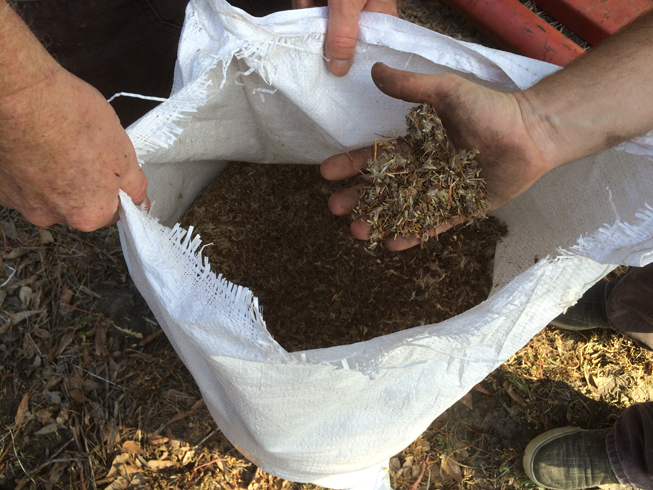
Any seeds from native grassland plants, except Dog Fennel (Eupatorium capillifolium), were fair game. Some of the plants had already shed their seed inventory or had it consumed by hungry birds and other wildlife. However, the sun and 70-degree Fahrenheit weather quickly dried the condensation from the seeds that remained ensuring that they would not rot prior to being spread in the nearby grassland restoration plots.


Thanks to Sudie Daves from the Calhoun County Natural Resources Conservation Service (NRCS) office for her technical assistance and plant identification. Thank you also to all the volunteers that came out on this warm December day to pick seeds. The restored grassland sites will be a wonderful gift to our native wildlife!

Images by Mark Musselman

Tuesday, January 30, 2007

Grassland For Birds


Audubon South Carolina plans to create perennial, warm-season grassland on 38 acres of newly acquired land on the Spring Branch tract. This grassland will be for the benefit of grassland bird species, specifically sparrows, buntings, bobwhite quail and other ground-nesting birds. Grassland habitat is diminished through conversion to agriculture, conversion to managed forest, and development.

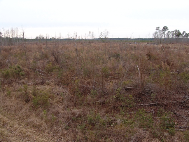
The soils on the plot have been identified and a plan has been created for the grassland restoration. Today, staff from the Francis Beidler Forest used Global Positioning System (GPS) technology to plot the boundaries of the proposed grassland and to calculate the acreage (38 acres). The view in the image is from west to east.

Wednesday, February 06, 2013

Sparrow Banding

Between January 26th and January 29th, we were banding sparrow species in a variety of habitats.  Mark LaBarr, Audubon Vermont and a federally certified bird bander, flew down to coordinate the proceedings and band the captured sparrows.

In the eastern United States, grassland habitat continues to disappear and consequently bird species that prefer that habitat are also in decline.  Previously, we have reported on our efforts to restore grassland habitats within the Francis Beidler Forest.

The four days of banding began at the recently burned Spring Branch grassland restoration site.

Unburned and burned Spring Branch - Mark Musselman
Lex Glover removing sparrow - Mark Musselman
Other certified banders, Lex Glover of the South Carolina Department of Natural Resources (SCDNR) and Aaron Given of the Town of Kiawah, were on site to assist with the banding and data collection, but the significant help came from the Summerville High School Navy Junior ROTC volunteers.  The effort to capture and band sparrow species is not like some netting stations which are situated to be in the flight paths of birds conducting their normal activities.  Sparrows spend the majority of their time on or quite close to the ground, so they need to be flushed from their cover towards the mist nets.  That is where the extra bodies proved to be invaluable.

Purple line shows track of Mark Musselman during the day of banding
The middle of the three sections shown above in orange was the only section not burned.  The nets were initially set along the fire break to the west and set later along the fire break to the east.
Summerville HS NJROTC volunteers - Mark Musselman
With the large grassland habitat and small coverage area of the mist nets, the sparrows would have had no trouble leaking around the three banders and three Audubon staff members trying to drive the birds towards the nets.  However, with the quantity of high school volunteers joining the effort, we were able to cover a wide swath of the grassland and curl in the ends of the line to keep the birds moving directly away from the noise and humans and towards the waiting nets

The majority of the approximately 60 sparrows captured were Song Sparrows and Swamp Sparrows.  However, there were also several Savannah Sparrows and one Grasshopper Sparrow as well as an overly curious Northern Mockingbird.  The mockingbird was shown to the students and released without any bands, but all sparrows were given an official United State Geologic Survey (USGS) band.  You can read more about the North American bird banding program here.

Mark LaBarr with Northern Mockingbird - Mark Musselman
Savannah Sparrow - Mark Musselman
Grasshopper Sparrow - Mark Musselman
The second day of banding include a shut-out at the Longleaf Pine restoration site.  The emerging pine habitat still has a significant number of short oaks and wiregrass ground cover, which is clumpy and not nearly as dense as the grassland habitat at Spring Branch.  A return to Spring Branch later in the day resulted in additional sparrows being captured and banded, but without the large number of volunteers, we did not capture anything close to the numbers we saw flying over and around the nets and the six humans.
Clark tract - Longleaf Pine restoration
Days three and four were spent at the Oakridge landfill in Dorchester County and the Bees Ferry landfill in Charleston County.  Although landfills seldom, if ever, evoke images of wildlife habitat, they can be beneficial to some species once portions or the entire landfill have been closed.  Once a section or cell of the landfill has been capped, grasses are encouraged to grow on top and on the sloped sides in order to prevent erosion of the capping material.  Trees, however, are no allowed to grow as their roots would penetrate the capping material, which would allow water in and pollutants out of the waste cell.  Driving the mist net poles in to the ground would have the same effect as tree roots, so the poles needed to be set in buckets of sand.  This sounds good in principle, but the occasional gust of wind would topple at least one pole, which would in turn pull down several others.  Valuable time was then spent picking grass, twigs, and blackberry stems from the delicate nets.
Oakridge Landfill
Oakridge landfill has the distinction of having the highest point in Dorchester County at an elevation of 255 feet.  The small grassy lump in the left half of the panorama below is that high point.

Panoramic view from top of Oakridge landfill - Mark Musselman

Methane capture - Mark Musselman
Mark LaBarr removing sparrow - Mark Musselman
Setting mist nets - Mark Musselman
House Wren - Mark Musselman
Although we did not take pictures of the second site closer to the top of the landfill (see panorama above) was much more like an open grassland.  The site was full of sparrows, but we were again plagued with a limited number of bird drivers.  Additionally, the steep slope worked in the birds' favor.  When flushed from their cover, the birds flew straight out before diving back down for cover.  Unfortunately, straight out put them over the top of the mist nets running parallel to the contour of the hill.  The sparrows were not captured and banded, but their presence was noted and the habitat deemed suitable for grassland sparrow species.

Bees Ferry landfill was the site of the final day of banding.
Bees Ferry Landfill
Help from a variety of volunteers made it possible to set the poles and nets on an increasingly windy day.  Like the Oakridge landfill, poles could not be set into the ground to avoid puncturing the cap and or lining material.  Now, with an ample force of volunteer bird drivers, we lacked the bird numbers we had seen on previous days!

Mark LaBarr removing sparrow - Mark Musselman
Mark LaBarr setting nets - Mark Musselman
Volunteers helping set nets - Mark Musselman
First for Mark LaBarr, Le Conte's Sparrow - Mark Musselman
The day began with a breeze and the winds continued to increase in advance of the approaching cold front.  Setting the nets, already difficult with the sand-in-bucket system, was all the more frustrating due to the random gusts of wind.  However, Mark LaBarr was able to band his first Le Conte's Sparrow and landfill supervisor, Ron Tibbetts, was able to release one of the banded sparrows.
Mark LaBarr helps Ron Tibbetts release sparrow - Mark Musselman
Setting net at second site - Mark Musselman
Although wind and manpower prevented all of the observed sparrows from being captured and banded, we were successful in determining the general usefulness of a variety of grassland habitats to support wintering sparrow species.  In the end, sites like the landfills might mow less, which would save them money (salaries, fuel, maintenance) and provide better habitat for bird species in search of a winter home.

The birds banded over the four days will soon be heading north to establish breeding territories.  It's a long shot, but it is possible that Mark LaBarr could capture in his springtime nets a bird he first met here in South Carolina!

Monday, September 08, 2008

Clearing

Due to the approach of Tropical Storm Hanna on Friday, we cleared the office early at the Audubon Center at Francis Beidler Forest. Thankfully, there was little wind associated with the storm and therefore no boardwalk repairs waiting for us on Saturday. Unfortunately, there was also precious little rain associated with the storm. Our rain gauge at the nature center showed only 1" fell on site. The swamp remains rather dry and the skies continue to be clear.


Today, clearing began on three 2-acre parcels in the grassland restoration site near the US Hwy 15 and I-26 intersection. As we've previously written (entry 1 and 2), this restoration project will create perennial, warm-season grassland on 38 acres of previously-logged land. This grassland will be for the benefit of grassland bird species, specifically sparrows, buntings, bobwhite quail and other ground-nesting birds. Grassland habitat is diminished through conversion to agriculture, conversion to managed forest, and development.

Although it doesn't look pretty today, the rich smell of dark, turned earth indicated to us that the grassland ecosystem will thrive on this site.

Images by Mark Musselman

Monday, December 12, 2016

Grassland Restoration

Grassland bird species are in decline, mainly from loss of habitat, which is why grassland conservation and restoration are part of the National Audubon Society's strategic plan.

With a cost-share grant from the United States Fish and Wildlife Service (USFWS), Audubon South Carolina committed to convert recently purchased agricultural fields to grasslands. These fields are adjacent to Mims Road across from the driveway entrance to the Francis Beidler Forest.

After decades of use for agriculture, the fields held few desirable plant species in the soil seed bank. Most of what volunteered was dog fennel (Eupatorium capillifolium), which would form a dense, sun-blocking thicket having little wildlife value. Therefore, the first step in the conversion was to herbicide the emerging vegetation in order to clear the site for the introduction of desirable grassland plant species.

Plants referred to as "ag weeds" in fallow field - Image by Mark Musselman
The fields one month after planting.

Field across from driveway - Image by Mark Musselman
Field across and right from driveway - Image by Mark Musselman
Field right from driveway across Cantley Rd. - Image by Mark Musselman
The first two fields shown above were planted in grassland mixes (Showy Wildflower and Mixed Meadow). The third field will receive longleaf pine seedlings this winter, so it was planted in a longleaf pine understory mix. The plantings were accomplished through the use of the USFWS seed drill, which was towed behind our tractor. Seeds are placed in the hopper where agitators feed seed into separate tubes leading to the seed drills. A harrow disturbs the soil ahead of the seed drills. The seed drills place the seed at the proper depth below the soil surface before a set of compacting wheels ensure the seeds are covered and in good contact with the soil.

Seed drill on transport trailer - Image by Mark Musselman
Seed mix prior to loading into seed drill - Image by Mark Musselman
After three month, the fields showed green with a mix of wildflower colors vying for attention.

Field across from driveway - Image by Mark Musselman
Butterfly Milkweed (Asclepias tuberosa) - Image by Mark Musselman
False Sunflower (Heliopsis helianthoides) - Image by Mark Musselman
Partridge Pea (Chamaecrista fasciculata) - Image by Mark Musselman
Indian Blanket (Gaillardia pulchella) - Image by Mark Musselman
The grasslands will be burned annually to prevent trees from becoming established, to reduce fuel (dead plant material), and to invigorate new plant growth. Due to the dry weather since Hurricane Matthew, we have been waiting for some precipitation to fall before conducting a prescribed burn. The rain over the last week certainly fits that bill, so now we wait for the next day with winds out of the south or southwest to ensure any smoke blows toward the swamp and away from neighbors' homes.

Ready for winter burn - Image by Mark Musselman